Restoring, conserving and expanding mountain pastures and wetlands and improving communal management in Canchayllo, Peru
Summary
The solution highlights an Ecosystem based Adaptation (EbA) measure that was implemented inCanchayllo, Peru. Working together with scientists and practitioners, Canchayllo community members decided to repair a water dam and rehabilitate an old, unused water channel.
This adaptation solution was implemented by the community of Canchayllo and Instituto de Montaña in partnership with the Nor Yauyos Cochas Landscape Reserve and IUCN. It combined traditional (indigenous), local knowledge with the latest science and comprised three components: (1) Strengthening community organization, (2) Strengthening local capacities and (3) Combined green and grey infrastructure.
The project led to the recovery of a network of ancient ditches in the communal farmland and surrounding areas that now supply water to 560 ha of pasture lands. In addition, the water is recharging temporary ponds and underground aquifers that supply water to pits and springs in the lower part of the Jaramayo micro-catchment and the Cochas – Pachacayo sub-basin.
Overview
- Location:
- Implementation sites:
-
- Single country
- Single location
- Mountain region:
-
Andes, Pariacaca
- Province:
-
- Junín, Jauja
- Site locations:
-
Distrito de Canchayllo, Nor Yauyos-Cochas Landscape Reserve
- Solution scale:
- Area Covered:
-
- 5.6 km2
- Ecosystem type(s):
- Solution type(s):
- Sector(s):
- Climate impact(s) addressed:
- Climate impact time-scale(s):
- Main benefit associated with the solution:
- Co-benefit(s) associated with the solution implementation:
- Sendai targets:
-
- SDGs:
-
-
Solution details
Main beneficiaries & outcomes
Main beneficiaries
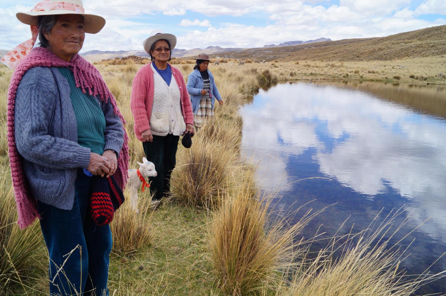
- Direct: 60 families related to livestock-farming in the rural community of Canchayllo.
- Indirect: 150 families (approx. 700 persons) in the community of Canchayllo and population living in the middle and lower part of the watershed.
Key outcomes
The water storage capacity of the community area improved due to repairs made to the Chacara lake dam. In September 2015, a flow of 184 litres per second was recorded. With the rehabilitation of the main channel, Chacara-Jutupuquio (2,855 m), water availability in the upper part of the community increased. Wetland zones and troughs were formed and an ancestral water channel was recovered in the area under collective management. This restored channel—a combination of a PVC pipeline and infiltration ditches with water distribution and regulation functions—supplies water to 560 hectares of native pastures and grazing sectors.
The probability of fires was reduced due to higher humidity in the pastures. Bird sightings, such as ducks (Anas flavirostris), have increased. These can be spotted in the lagoons or temporary qochas (natural ponds), which are formed by the water that runs through the restored channel and system of ditches. Three hectares of native pastures have been recovered in a natural way through demonstration plots.
Planning and implementation
Building block 1: Strengthening of Community Organization
Under the component “Strengthening of Community Organization,” a management plan was developed to promote integrated management of pastures, water and livestock throughout the communal territory of Canchayllo. The goal was to strengthen community organization so that water could be distributed more effectively and grazing areas could benefit from improved rotation. The process to develop the management plan was facilitated by Instituto de Montañae using a methodology to strengthen capacities, stimulating collective and social practices within the community. The plan is defined as a set of ideas that emerge from a given population by means of an in-depth process of analysis based on their own perspectives. The management plan can also serve as a tool for local management in the medium term.
According to the keen interest of this community, analysis and planning have focused on grasslands and water. The plan also encouraged the community to establish a committee to maintain and operate the renovated water infrastructure so that the water continues to flow and grasslands continue to be irrigated. In addition, a document with technical recommendations was developed for managing communal grasslands.
Building block 2: Strengthening Local Skills and Knowledge
As part of the “Strengthening Local Skills and Knowledge” component, the team conducted courses and workshops, facilitated discussion events, and led training on how to apply pasture recovery techniques and evaluate their effectiveness. These activities helped sensitize community farmers, inspiring them to create new, small projects such as fencing and recovery of pasturelands or water and livestock management. In addition, the monitoring system applied shows that skills for pasture management, with regard to evaluation, fencing and recovery at the family and community levels, have increased (IM, IUCN, 2015). As part of the communication activities, an informational showcase and two participatory videos, a theatre play and publications were produced. This contributed to raising awareness among the group of livestock farmers regarding pastures, water and livestock management and helped disseminate information about the project at community and landscape reserve levels (IM, IUCN, 2015). Information was generated through participatory rural diagnostics (specific studies in water, pasture, archaeology, social organization, productive activities) and a hydro-geological study in the water channel’s area of influence.
Building block 3: Recovery of Technologies & Green-Gray Infrastructure
In the “Recovery of Technologies & Green-Gray Infrastructure” component, the Chacara dam was repaired and an old and unused water channel was rehabilitated. This allowed the recuperation of a network of ancient ditches in the communal farmland and in the high areas of Yanaututo and Pumapanca. These areas supply water to 560 ha of pasturelands (Hidroandes, 2015). In addition, the water is recharging temporary ponds and underground aquifers, that supply water to pits and springs in the lower part of the Jaramayo micro-catchment and the Cochas – Pachacayo sub-basin (Idem, 2015). A pilot area of 3 ha was fenced to protect pastures as they recover. It is monitored by the Landscape Reserve administration with support from the community. The community also contributed manpower to the activities in this component.
Finance
This program is part of the International Climate Initiative (IKI). The Federal Ministry for the Environment, Nature Conservation and Nuclear Safety (BMU) supports this initiative on the basis of a decision adopted by the German Bundestag.
Our Mountain EbA Program is led by Instituto de Montaña and implemented jointly with the International Union for the Conservation of Nature (IUCN) and country partners over the period 2017-2022.
Innovation
N/A
Long term project sustainability and maintenance
The solution’s three building blocks were are articulated in a way that contributes to the initiative’s sustainability. The technology-based infrastructure combined with activities to strengthen technical and organizational capacities build the basis for the measure’s sustainable implementation and maintenance.
Comments
There is no content